The content of this page needs an update version of your flash player :

3D scanning in the interests of heritage resources
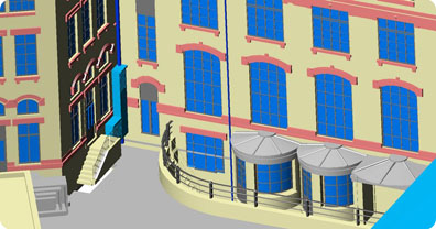
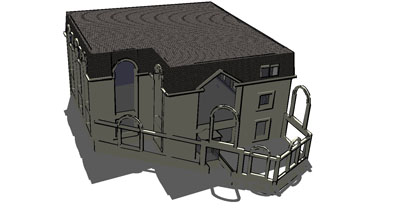
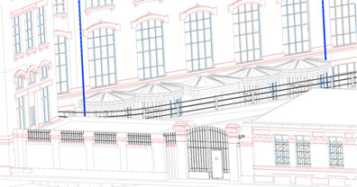
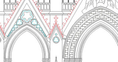
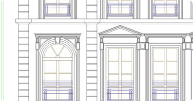
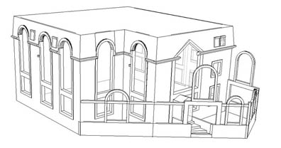
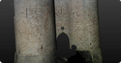
The 3D scanning technology used by Urbica is particularly well-suited to capital assets and their associated requirements. Urbica can undertake the 3D modelling of all types of civil engineering structures (bridges, water towers, roads, tunnels) or buildings (religious, cultural, sporting) to a level of accuracy on the scale of centimetres, and with photorealistic rendering. Lasergrammetry can also be used for the generation of conventional façade plans, plan views, section diagrams, intersections, elevations and profiles at any point on the digitized edifice. Do you know that 40% of time in a project is taken up by looking for the right information?
he benefits of Urbica:
The majority of Urbica services can be executed with no interruption to site operations.
Urbica delivers 3D models which are compatible with virtually all CAD softwares.
Applications
The Urbica team of surveyors undertakes the following on a regular basis:
- Partial or complete surveys of structures
- Generation of point clouds
- 3D models, 2D plans
- 360° HD panoramic images
- 360° HD virtual inspections
- Analysis of clashes between plans and actual conditions
- Updating of plans
- Control of strain, subsidence, flatness, volume.
Types of installations operated
- Civil engineering structures
- Listed buildings
- Commercial and administrative premises
- Industrial facilities