
The content of this page needs an update version of your flash player :

Cartography and geographical information
Urbica has specialized in cartography since 1986. Frequently working from old hard copy plans, we can faithfully reproduce the data content of technical documents (including the detection of errors) in the form of files for incorporation in a GIS.
Land registry plans, system plans, geological or bathymetric maps, cartographic atlases, land use plans, urban development plans, land development plans, risk prevention, road routes, etc.
For all these operations, we can place over 20 years of expertise at your disposal.
We can offer a consultation facility in advance of these services as part of an overall approach which is stringent, technically feasible and of appreciable financial benefit.
Digitizing Networks
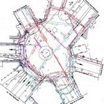
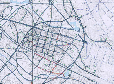
 Digitizing the heating network of CPCU company
The objective sought by system operators (for drinking water, sewage, electricity, telecoms) is to obtain data files which can be processed in their Geographic Information System. The service provided involves the accurate, exhaustive and coherent digitization of cartographic information required to ensure the integrity of the data base, which will be constructed in accordance with the conceptual data model.
The network is represented on a base plan of the town concerned, which is either retrieved or generated by Urbica: this will be an existing base plan held by the system operator, or a plan generated on the basis of data files obtained from the property tax authorities. This base plan is then converted into the same exchange format as the system diagrams which are to be superimposed thereupon.
The network will be entered on the base plan and updated manually. Two further cartographic sources supplement the documents which are to be digitized: the distribution system and the identification of facilities.
Digitization does not simply entail the digital encoding of a graphic document with a view to producing an identical reproduction. Scanning would suffice for this purpose.
This is not the case where digitization is required to fulfil the following functions: the improvement or enrichment of existing graphics (standardization of fonts, generation of colours, etc., in accordance with the attributes concerned), or the comprehensive and unambiguous clarification of relationships represented by graphic documents (what is the diameter of each line section ? Which line section is associated with a given address ? ).
The methods and tools required for this purpose employ techniques which are more associated with relational data base management systems than with infographics proper.
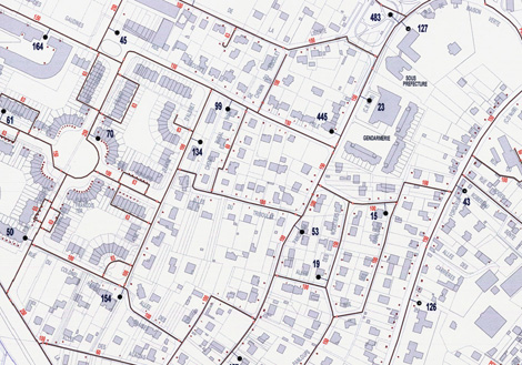

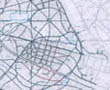
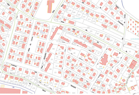
Land registration
Frequently misunderstood, land registration is nevertheless an extremely useful service. All properties (land, houses and apartments) are described in the land registry in terms of geographical location, surface area, number of rooms, etc.. These records are specifically used by government authorities to determine the amount of property taxes and local taxes, but also by notaries and private individuals, in conjunction with deeds of sale or purchase.
Urbica offers three main products for land registry digitization :- Urbi-Scan: scanning of hard copy plans, assembly and clean-up of raster image files,
- Urbi-Digit: digitization of plans in accordance with your style identity guide,
- Urbi-DGI: digitization of plans in accordance with the EDIGEO standard.
back to top of page
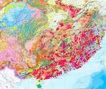
Geology
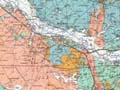
For the rapid and accurate structural identification of sub-surface geological strata, Urbica also undertakes the digital plotting and digitization of various types of geological and mining maps throughout the world.
Source data will take the form of tracings and plans.
The service provided involves the digitization of geological features in "vector" form.
The polylines and polygons thus obtained, coded according to type, are rigorously superimposed to ensure the generation of topologically accurate data.
back to top of page
REFERENCES
