The content of this page needs an update version of your flash player :

Flatness controls
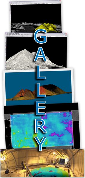
Flatness control, which involves the quantification of deviations between an existing surface and a notional model, is a field where laser scanning is indispensable.
The conventional technique, described as the "2 metre rule" is not always appropriate to the flatness control of large plane surfaces, such as sports halls, concrete foundation slabs or façade walls.
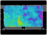
The processing of clouds of points generated by 3D laser scanning will allow the comprehensive comparison of actual conditions with notional plans, revealing variations with an unparalleled degree of accuracy and ease of reading (colour maps of deviations, profiles, etc.).
The end product is a genuine decision-making resource for checks, analyses and inspections.
APPLICATIONS
- Control of civil engineering structure (direction of creep)
- Control of machined component
- Control of sports facilities (hall, field and track)
- Comparison of successive states
back to top of page
BENEFITS
- Detailed scan matrix of the point cloud
- Accuracy to the millimetre
- Large-scale data capture
- High-speed scans
- Comprehensible data files
back to top of page
END PRODUCTS
- Files types: Autocad (DXF/DWG), Microstation (DGN),
Solidworks, 3DStudioMax (3ds & max), Realworks (RWP),
Pointools (POD/PTL) , PDMS (macros), PDS, and of course all the open format files like IGES, OBJ, STEP, VRML etc... - 3D mesh
- Points cloud
- 2 dimensional images illustrating the deviations
- 2 dimensional digitized file ( cut sections, layouts,…)
- Scan-review (Collaborative review of laser survey through panoramic images)
back to top of page
REFERENCES